The ShakeAlert earthquake early warning system demonstration system that is currently being tested by UC Berkley, USGS, and other organizations, provided about a ten-second warning for the UC Berkley Seismo Lab before this morning's 6.0 magnitude earthquake near Napa, as seen in this video released by the UC Berkley Seismo Lab.
Sunday, August 24, 2014
Friday, March 7, 2014
The First Major Storm System of the Year in SoCal
The first major storm system of the year entered Southern California late last week on Wednesday night, bringing light to moderate rainfall with rainfall totals of less than an inch of rain to the LA Basin. The rain gauge at my location in Del Rey (just north of Playa Vista) recorded just over an inch of rain, at 1.10" in twenty-four hours, ending at five in the evening on the twenty-seventh.
The second storm system, which brought significant rainfall totals moved into the area Thursday night into Friday, and lingered in the region until Sunday afternoon. The National Weather Service stated that rainfall totals of up to four inches of rain in coastal areas, and rainfall totals of up to six inches in foothills and mountain areas. In this storm my rain gauge located in Del Rey recorded 1.83 inches of rain (our area remained relatively dry compared to other areas) for the second storm.
Overall, rainfall totals, as stated by the National Weather Service were:
-4.52" for Downtown LA
-5.40" for Pasadena
-1.97" in Lancaster
-6.21" for Ojai
The National Weather Service also stated that the highest rainfall total in the Los Angeles/Oxnard region was at Matilija Canyon, at 14.54" of precipitation recorded.
 |
| Moderate Rainfall Over Los Angeles |
Overall, rainfall totals, as stated by the National Weather Service were:
-4.52" for Downtown LA
-5.40" for Pasadena
-1.97" in Lancaster
-6.21" for Ojai
The National Weather Service also stated that the highest rainfall total in the Los Angeles/Oxnard region was at Matilija Canyon, at 14.54" of precipitation recorded.
Friday, December 27, 2013
2013: What Seems to be Los Angeles' Driest Year on Record
This Christmas, residents and tourists alike in Southern California received an unusual gift: 80 degree weather. Such nearly record-breaking temperatures can be attributed to a high pressure system over the great basin, which created an offshore flow that funneled hot air into the southland.
However, this calendar year has been dubbed "LA's Driest" with only 3.60 inches of rain, far below the yearly average of 14.91 inches. According to the National Weather Service, the current (soon to be former) driest calendar year on record tied between 1953 and 1947, when only 4.08 inches of rain fell on downtown LA.
Fortunately, this "rainfall year" which began July first and will culminate on June 30th of next year, is not near the driest, the record-holder being the 2006-2007 rainfall year with only 3.21 inches of rain total.
With Santa Ana winds and rising temperatures expected over the next few days, the fact that 2013 will be the driest calendar year on record for Los Angeles is becoming set in stone.
Sunday, November 3, 2013
Governor Brown Signs State Bill 135: Earthquake Early Warning for California
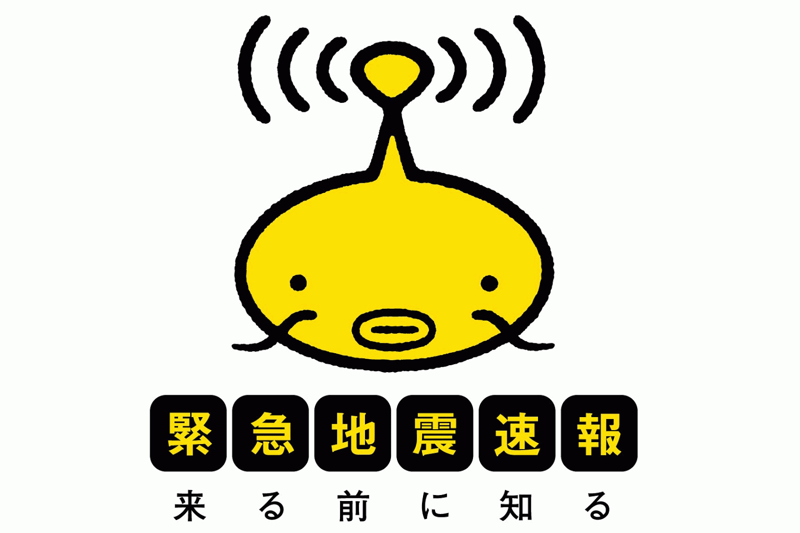 |
| Namazu: Japan's Symbol For EEW |
Earthquake early warning involves a network of seismometers that detect the fast moving p-wave of an earthquake, that has a small amplitude, which makes it less damaging than other waves. A computer program then estimates the location and magnitude of the earthquake, before sending out warnings to the public. The warnings reach the public (usually) before the slower and more damaging s-waves and surface waves, that have larger amplitudes, arrive. This is similar to the way we see lightning before we hear thunder.
The light from the lightning travels at the speed of light, while the sound of the thunder travels at the speed of sound. The closer you are to the lightning strike the more quickly you hear the thunder. This is similar to earthquake early warning. Warnings are sent at nearly the speed of light, while earthquake waves travel at about the speed of sound. The closer one is to the epicenter of the earthquake, the shorter the amount of warning time that person will receive.
For more information view my other posts regarding earthquake early warning.
Friday, September 20, 2013
Earthquake Early Warning- State Bill 135 Heads Toward the Governor
Just recently on September 12th, the California State Assembly Passed "California State Bill 135," that if signed by the governor before October 13th will create a comprehensive state-wide earthquake early warning system for the state of California. The earthquake early warning system, covered to a greater extent in my earlier posts, will be able to provide precious seconds of warning before an earthquake, in some cases upwards of a minute of warning (as in Japan and Mexico City).
You may ask, how does earthquake early warning function?
Earthquake early warning systems do not predict earthquakes. Instead, they consist of a network of seismometers (The California Integrated Seismic Network in the case of the state of California), that detect the fast moving P-waves of an earthquake when it occurs. The data from the P-waves are used to determine the magnitude as well as location of the epicenter, and warnings are quickly sent out to those who will be affected.
California State Senator Alex Padilla (who introduced the bill) stated in a press release on the 12th:
"We live in earthquake country. When it comes to earthquakes in California, it is not a matter of if, but when. A fully developed earthquake warning system will provide Californians critical seconds to take cover, assist love ones, or pull over safely to the side of the road. It could allow time to stop a train and power down critical infrastructure. Most importantly it will save lives."
Currently a prototype system known as Shakealert is in place, however it is not yet ready for public use.
A video of the earthquake early warning system in Japan during the 2011 Tohoku Earthquake is shown.
For more videos on earthquake early warning visit my up-to-date post: Videos of Earthquake Early Warning
Friday, August 30, 2013
Monsoonal Moisture And Flash Flooding in LA County
I just took a video of my weather radio going off when the warning was issued.
With monsoonal moisture and triple-digit heat today in much of SoCal, nearly non moving storm-cells have been producing heavy rain in the mountains and in the Antelope Valley of LA County as well as throughout the desert areas. A flash flood warning was just issued for portions of the Antelope Valley due a thunderstorm producing heavy rainfall.
The National Weather Service stated that:
" FLASH FLOOD WARNING FOR...PORTIONS OF THE ANTELOPE VALLEY
INCLUDING LITTLE ROCK AND PEARBLOSSOM  AND THE ADJACENT NORTHERN
SLOPES OF THE SAN GABRIEL MOUNTAINS... UNTIL 830 PM PDT"
Thursday, July 25, 2013
The Tierra Rejada Vernal Pool Filled With Water

 |
| These Two Images Were Of the Tierra Rejada Vernal Pool in the Winter of 1997-1998 Images Courtesy of Balance Hydologics Inc. |
Wednesday, July 17, 2013
Right Smack in the Middle of LA
 |
| Guess Where This Picture Was Taken. |
 |
| Now Guess Where This Picture Was Taken. |
 |
| Blue Arrows Marks the Apparent Path of the Creek The Green Arrow Marks the Camera Angle of the First Picture |
You may be surprised, but these two pictures were taken less than a block away from each other. The street in the second picture is Wilshire Blvd. in West LA. The picture of the "canyon" was taken just to the north of Wilshire near the Brentwood Country Club. The "canyon" apparently has a creek or seasonal creek in it (L.A. Creek Freak posted maps of the creeks in LA). It's interesting how there is a little piece of nature in the middle of the city.
Thursday, July 11, 2013
Monsoonal Moisture Makes its Way Into SoCal
 Monsoonal moisture is making its way into SoCal with at least a chance of isolated showers and thunderstorms throughout the area.
The National Weather Sevice has stated that:
"Widely scattered showers will move through southwestern California today through Friday. Most locations will recieve little to no rainfall as the showers move through the region, however brief periods of moderate rain and gusty winds will accompany occasional bands of heavier showers."
My rain gauge in Del Rey, Los Angeles has recorded about .05" of rain since yesterday morning.
Visit the National Weather Service's Webpage for more detailed information.
Monday, July 8, 2013
Think More Landscape, Less Hardscape- At Ballona
 |
| Where's the Restoration Annenberg? I don't see any. |
I feel that Annenberg should completely start from scratch on their proposal and think like Malibu Legacy Park, that has interpretive signs around a series of trails, as opposed to a single large building that is disconnected from nature.
Less Hardscape, More Landscape
Saturday, June 29, 2013
Near Record Temperatures in SoCal (and the entire southwest)
 |
| Maximum Temperatures for 5/29/13 in the Southwest Courtesy of the National Weather Service |
For more information visit: The National Weather Service
Wednesday, June 19, 2013
Rim of the Valley Corridor Study
 |
| The Tierra Rejada Endangered Species Preserve that has been recently bisected by Urban Sprawl The Vernal Pool toward the left of the picture is the home of the Endangered "Riverside Fairy Shrimp" Underwood Farms can be seen toward the background (Image property of SoCal Earth Science Blog) |
The Study
I recently stumbled upon the "Rim of the Valley Corridor Special Recourse Study" by the National Park Service, which can be seen here: http://www.nps.gov/pwro/rimofthevalley/Newsletter3EnglishWEB.pdfTo sum the document up, there are four alternatives:
Alternative A - No Action
Alternative B - Cooperative Conservation Partnership
-SMNRA partners with other land owners and managers to protect and expand open spaces
Alternative C - Connecting Urban Communities
-Adds more of the eastern study region to the SMNRA
Pros:
-Includes the Verdugo Hills
-Includes open space close to urban Los Angeles
-Provides corridors to nearby Angeles National Forest
Cons:
-Does not provide corridors to the Los Padres National Forest
-Does not include most or all of the Santa Susana Mountains and Simi Hills
-Does not include land in Ventura County that is/will be subjected to urban sprawl near Moorpark and Thousand Oaks
Alternative D - Connecting Natural Habitat
-Adds more of the western study region to the SMNRA
Pros:
-Includes the Santa Susana Mountains and more of the Simi Hills
-Provides corridors to the nearby Los Padres and Angeles National Forests.
-Includes areas that are at risk to habitat fragmentation
Cons:
-Does not include the Verdugo Hills
-Does not include connections to urban Los Angeles
My Stance
I feel that an alternative that is a hybrid of C and D, would be adequate. One that includes natural areas and corridors, as in alternative D, but also protects the Verdugo Hills, as in alternative C.
If I had to choose between the two, although many may argue that Alternative D would not bring as much parkland into the Los Angeles Area, Alternative D would prevent habitat fragmentation and include the almost completely unprotected Santa Susana Mountains and Simi Hills. Thus, I would go with alternative D.
I have experienced the horrible fragmentation every time I visit my friends in Moorpark. Much of Moorpark was once open space and farmland. However in recent years, developers have developed even ecologically sensitive regions. This can be seen in a relatively recent development that bisects a small watershed that drains into a vernal pool (home of the endangered Riverside Fairy Shrimp). Although developers have stated that they have minimized their impact, by not destroying the vernal pool, they have destroyed much of the watershed that provides the pool with water every few years, and created a system of concrete ditches that artificially transport water around the development and to the pool. This can be seen in the image at the top of the page.
To prevent such atrocities from destroying more natural areas in Ventura County, I would support Alternative D to protect vulnerable areas that are at a significant risk.
Thursday, June 6, 2013
Playa Vista Phase 2- Littering by Construction Company and Non-Cutoff Light Fixtures
 |
| Full-Cutoff Light Fixture in Del Rey |
 |
| Non-Cutoff Light Fixture in Playa Vista |
I was just walking along the "Playa Vista Riparian Corridor"a rerouted version of the original Centinela Creek. I noticed that construction workers that were restoring a former hanger that was once owned by Howard Hughes that was adjacent to the Riparian Corridor did not pick up their trash. The trash was allowed it to drift into the Corridor as well as a neighboring park. Hopefully, it will be picked up.
Another story, I have been annoyed for a long period of time by the fact that Playa Vista has installed street lights that produce heavy light pollution (see image). This is going against what the city of LA has been trying to do for the past few years-- use full cut-off LED light fixtures to help conserve energy and to reduce light pollution. The developers have been continuously stating the idea that Playa Vista is a "green development." However, they are being anti-green by using the light polluting, non-cutoff, and energy wasting sodium vapor light fixtures not only in the older Phase 1, but in the new Phase 2 as
well.
Monday, June 3, 2013
California's Earthquake Early Warning System is Passed by the Senate
This video was created by "EHSUCBerkley"and includes Peggy Hellweg, a geophysicist at UC Berkley discussing the Shakealert System.
(Courtesy of EHSUCBerkley)
On May 28, 2013, the California State Senate voted unanimously (39-0) to pass "State Bill 135," which will create a comprehensive state-wide earthquake early warning system form the state of California.
The bill states that the bill, if passed by the assembly and signed by the governor, will require:
"(1) Installation of field sensors.(2) Improvement of field telemetry.(3) Construction and testing of central processing and notification centers.(4) Establishment of warning notification distribution paths to the public.(5) Integration of earthquake early warning education with general earthquake preparedness efforts."
The bill will most likely be up for signing by the governor this fall.
In the mean-time... here are some posts on earthquake early warning in order by date:
Tuesday, May 28, 2013
Learning about what LA Used to Look Like

Most people overlook the history behind most things. You may just look at Penmar Golf Course and Penmar Park in Venice, and say that they are just normal recreational areas that just happened to be built there. You may just say that the Lagoon that bisects the "Silver Strand" in the Marina was just a remnant of Abbot Kinney's Canals. However, after closer inspection, one can learn that Penmar Golf Course was built on a vernal pool that would fill with water every winter, and that the "remnant" of the canals is truly a natural lagoon that once part of the ecologically diverse Ballona Wetlands complex, and that it was spared in the development of the Marina filled in nearly all of the wetlands.
A study by the Bay Restoration Foundation and USC has mapped the historical ecology of the Ballona Watershed, and has provided the information in a detailed manner, with images of the ecology superimposed onto google maps. You can find out what once existed where you now live, and what has survived the urban sprawl of Los Angeles over the past 100 years.
You can see the website, that includes historical ecology of the entire Ballona Watershed, superimposed onto google maps by visiting the link:
http://www.ballonahe.org/
Subscribe to:
Comments (Atom)